Across to Africa
11/09/07 16:14 Filed in: Cadiz to Kenitra 9-11 September 2007
9th September 2007
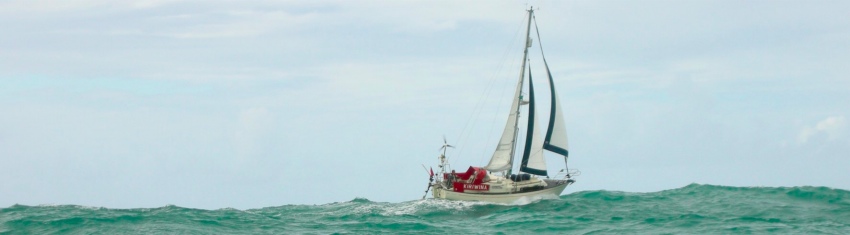
Up very early (06:00) for final preparations before leaving Cadiz at 08:00.
At first we had favourable but light winds and made slow progress with all sails up. As the day day progressed the wind veered from SE to W while maintaining F2-3. By Midnight we had covered only 28 miles.
During the night we saw a lot of Moroccan fishing boats and the VHF was alive with repeated calls from their skippers asking big ships to avoid crossing over nets.
There was also a steady stream of ships heading to or from the Strait of Gibraltar.
10th September 2007
Determined to avoid motoring we continued to sail at snails pace as the wind hovered around force 2 between S and NW. At 09:30 the foresails were furled and we deployed the ghosting genoa. By noon our mileage from Cadiz was 40.
At 14:00 with barely any wind we surrendered and put the engine on and motorsailed. At least we were making some progress.
At midnight our trip mileage was 80.
11th September 2007
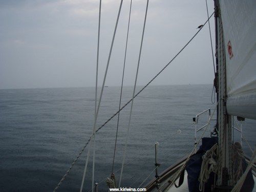
During the early hours the sea was flat calm. As the morning progressed heavy rain set in and we could see the coast of Morocco.
A small bird hitching a lift in heavy rain with small Moroccan fishing boats in the background.
On Kenitra, the 2 year old pilot book commented "..is consequently very quiet, safe, and clean". So we chose Kenitra as our first port in Morocco.
At 11:45 we arrived off the entrance to the River Sebou where we dropped the main and proceeded in.
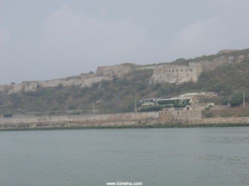
Old fort above the port of Mehdia at the entrance to the River Sebou
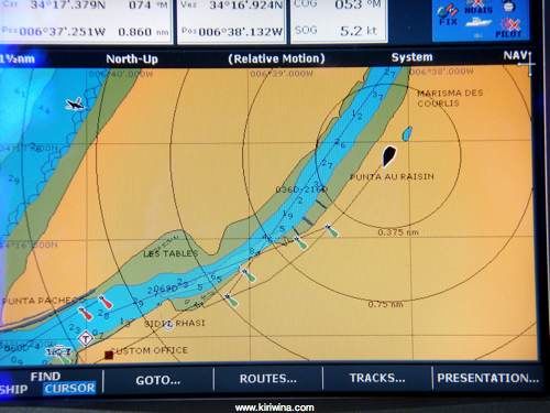
It was about 4 hours before highwater and we had to be careful to stay on the leads. Unfortunately these were difficult to identify and the GPS display showed us proceeding on dry land. Our Navionics chart was less than a year old and our Spanish paper charts were purchased less than two weeks ago. They were not a lot of help.
At 12:20 we kissed the muddy bottom at the edge of the shallows called Les Tables. We had been unable to spot the leads and wandered a tad too far to starboard.
After about 10 minutes the rising tide floated us off and we continued. The best policy was to stick pretty much to the middle but from then on we found most of the leads and followed a large fishing boat when we didn't.
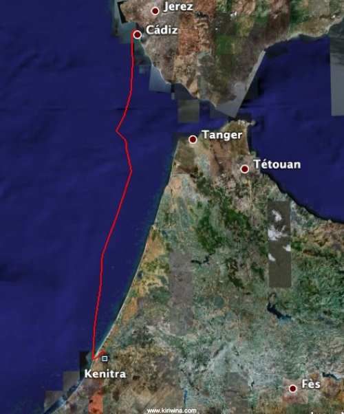
Our GPS track.
A lower lead on the River Sebou. The bush to the left helpfully obscures the lead until one is almost abeam.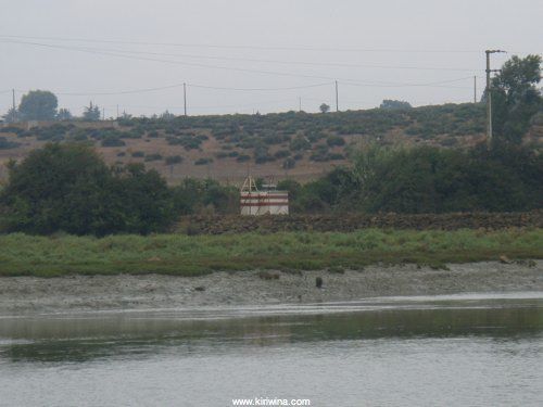
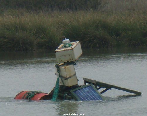
This buoy, marking a wreck, looks as though it is struggling to stay afloat itself.
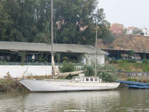
This rather tired looking British yacht was moored downstream of the main harbour.
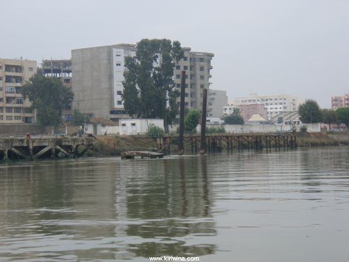
Entering Kenitra Harbour. Derelict quays and a wreck.
At 14:00 we arrived at Kenitra harbour. A trip of 2hrs and 10 minutes from the river mouth. The tide was in full flood and this part of the river was very very dirty. We had passed a sewer outfall about half a mile from Kenitra.
We got two lines ashore but did not moor. Instead we had a chat wth the harbour master who, while being very polite and friendly, strongly expressed the opinion that the port was not suitable or safe for small yachts. I agreed entirely. It might have been possible to find a space between the large tyre cluster fenders to moor but the quay had a substantial overhang which would have made it difficult and dangerous to be alongside as the tide fell. It would not have been possible to leave the boat unattended for any length of time.
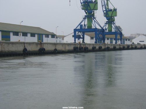
The quay at Kenitra.
Possibly we could have sat alongside a small bulk carrier that was loading but I decided to cast off and proceed to Mohammedia.
"..is consequently very quiet, safe, and clean" I don't think so and wonder whether the writer actually visited Kenitra.
Up very early (06:00) for final preparations before leaving Cadiz at 08:00.
At first we had favourable but light winds and made slow progress with all sails up. As the day day progressed the wind veered from SE to W while maintaining F2-3. By Midnight we had covered only 28 miles.
During the night we saw a lot of Moroccan fishing boats and the VHF was alive with repeated calls from their skippers asking big ships to avoid crossing over nets.
There was also a steady stream of ships heading to or from the Strait of Gibraltar.
10th September 2007
Determined to avoid motoring we continued to sail at snails pace as the wind hovered around force 2 between S and NW. At 09:30 the foresails were furled and we deployed the ghosting genoa. By noon our mileage from Cadiz was 40.
At 14:00 with barely any wind we surrendered and put the engine on and motorsailed. At least we were making some progress.
At midnight our trip mileage was 80.
11th September 2007
During the early hours the sea was flat calm. As the morning progressed heavy rain set in and we could see the coast of Morocco.
A small bird hitching a lift in heavy rain with small Moroccan fishing boats in the background.
On Kenitra, the 2 year old pilot book commented "..is consequently very quiet, safe, and clean". So we chose Kenitra as our first port in Morocco.
At 11:45 we arrived off the entrance to the River Sebou where we dropped the main and proceeded in.
Old fort above the port of Mehdia at the entrance to the River Sebou
It was about 4 hours before highwater and we had to be careful to stay on the leads. Unfortunately these were difficult to identify and the GPS display showed us proceeding on dry land. Our Navionics chart was less than a year old and our Spanish paper charts were purchased less than two weeks ago. They were not a lot of help.
At 12:20 we kissed the muddy bottom at the edge of the shallows called Les Tables. We had been unable to spot the leads and wandered a tad too far to starboard.
After about 10 minutes the rising tide floated us off and we continued. The best policy was to stick pretty much to the middle but from then on we found most of the leads and followed a large fishing boat when we didn't.
Our GPS track.
A lower lead on the River Sebou. The bush to the left helpfully obscures the lead until one is almost abeam.
This buoy, marking a wreck, looks as though it is struggling to stay afloat itself.
This rather tired looking British yacht was moored downstream of the main harbour.
Entering Kenitra Harbour. Derelict quays and a wreck.
At 14:00 we arrived at Kenitra harbour. A trip of 2hrs and 10 minutes from the river mouth. The tide was in full flood and this part of the river was very very dirty. We had passed a sewer outfall about half a mile from Kenitra.
We got two lines ashore but did not moor. Instead we had a chat wth the harbour master who, while being very polite and friendly, strongly expressed the opinion that the port was not suitable or safe for small yachts. I agreed entirely. It might have been possible to find a space between the large tyre cluster fenders to moor but the quay had a substantial overhang which would have made it difficult and dangerous to be alongside as the tide fell. It would not have been possible to leave the boat unattended for any length of time.
The quay at Kenitra.
Possibly we could have sat alongside a small bulk carrier that was loading but I decided to cast off and proceed to Mohammedia.
"..is consequently very quiet, safe, and clean" I don't think so and wonder whether the writer actually visited Kenitra.